Saturday, April 30, 2011

Week 35 Apr. 30 - Green Lake, again

Total Distance: Approximately 9 miles
Elevation Gain: Approximately 1400 ft.
 
Time: 8:45 am - 1:15 pm 
Weather: Overcast, cool, a little rainy early then a partly cloudy sunny afternoon.


This weekend I took 4 students and two adults from the Outdoor Club at my work to the same place I went two and a half weeks ago on my crazy mid-week hike.  While out on the mid week hike, I was telling my good friend from work that this would be perfect for a quick outing, if we wanted to bring the club out and time was a factor.  Sure enough, last weekend was beach clean-up, and this weekend was the weekend before AP exams start at school.  Many of our club members are enrolled in several APs.  So this seemed like a good hike to do early on Saturday, giving the rest of the day and all day Sunday to "study."  

First we all met at our normal  meet up spot this morning, and everyone was there early.  Four students (3 who had not been on a club hike before, and two co-workers (a person who had never been on a club hike and my best friend from work, crazy old hiker guy).  Took two cars, and made it to the trailhead in about an hour and 20 minutes. Learning from my last hike here, I took the time to put on my gaiters, and I strapped my snowshoes to the pack.  

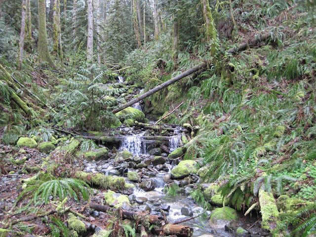
We started up the road and had a great time meandering along the washed out road through a beautiful old-growth along the mighty Carbon River.  After a short hour, we were at the Green Lake trailhead.  According to the Mt. Rainier signs, this was a three mile walk.  We started up the trail for Green Lake, again according to sign posts, this was a 1.8 mile walk.  The walk along this trail was really awesome.  I love getting to know a trail.  It was still covered with a lot of snow.  Some hikers in the last few days must have helped pack it down, and it was not necessary bring snowshoes. I recognized many of the switch-backs, I had a sense of timing and pace, I remembered vivid details like what the rocks on the trail looked like at the turn from Ranger Falls.  I naturally was excited to hike, again.  

Over the last few weeks, I have been shamelessly promoting my blog and my commitment to hike for an entire year.  People are very generous with their words when I mention this, and I get that the last 35 weeks are something to be proud of.  But this week, while walking, I was talking with the other adult who came along, and I really understood something about this particular commitment, and any commitment I make.  There is 100% left to go.  Now, I know I teach math, and 17/52 is about 0.32692.. or 32.7%.  But my commitment is to hike for 52 weeks, and there is still 100% left to go.  Each week holds the entire commitment alive, and holds the commitment in the balance.  Each week the reward grows beyond my expectations.  

Made it to the lake, some of the kids were there early with one adult.  I was in the back with the other kids and my hiker buddy.  We appeared to be the first visitors of the day.  Had the lake all to ourselves.  The clouds were lifting, revealing the brilliant blue skies of a spring day.  The warm sun rays shining at the lake and on our hike out were spectacular to my skin.  

We left the lake at 11:15 am and were back at the car by 1:15 pm.  Great talks with kids about life.  

Orchid: The hike.  

Onion: None. Cloudy morning, if I have to pick.  

Picture:

Published with Blogger-droid v1.6.8

Sunday, April 24, 2011

Week 34 Apr. 23 & 24 - South Duk, Beach Clean-up


Total Distance: Approximately 10+ miles
Elevation Gain: Approximately 150 ft.
 
Time: Saturday at 12:00 am - Sunday 2:30 pm 
Weather: Beautiful, warm, and sunny on Saturday. Mostly cloudy, cool, rainy Sunday with some sun breaks.


This weekend was the weekend of the Washington State Coast Clean-up sponsored by Washington CoastSavers.  I used this opportunity to help students at the school I work at earn community service hours and to have the school's outdoor club sponsor an overnight trip. Friday, after school, four high school seniors, a parent, and I drove 4 hours to the Lake Ozette Ranger Station with our gear for a 2-night 2-day trip.

Due to all the activities my students are involved with, we could not leave Tacoma until 6:30 pm.  We hit the road, stopped for dinner, and pulled into the campground at midnight.  We set up camp, and I found myself in my sleeping bag and dreaming in no time.  The next morning, I got up around 7:15 am and checked our group in with the volunteer coordinator.  I got a big role of trash bags, and I got the low down on how all of this needed to work.  We were going to hike 7 miles to our site, and pickup as much trash as we could carry out.  At the same time I was checking in a large group from the Friends of the Olympic National Park were checking in.  They were going to drive in using old logging roads and park access keys to just north of our site.  They had several trucks and were only going to be 2 miles from our section.  We worked out a plan and followed in our car.

We stashed our van in the woods, geared up, and walked to the beach.  The walk took only 15 minutes.  Then we were able to walk about 2.5 miles down south to the Ozette River.  This was the river we were going to ford from the south side.  The river was deep and moving quickly.  I was so happy we did not have to ford it.  We set up camp, had a quick lunch, and began clean the beach.  It took about 15 minutes to fill 8 trash bags.  We picked up plastic bottles, floats, buoys, rope, and all sorts of debris.  Then we walked it back the two and a half miles to the trucks parked at the end of the old logging roads.  This was a true "onion."

Some of you readers may know about "orchids and onions."  Most of you have probably inferred what it means, but here is the explanation I heard many years ago on a backcountry trip.  The orchid is the moment that was pure beauty.  The moment when you were awestruck by whatever was going on at the time.  So perfect it was like a wild orchid in full bloom.  The onion is that bitter moment.  So strong and overpowering you could cry or want to just never do anything like this again, when it took something deep inside you didn't know you had to persevere.  It is that moment that, like an onion, when it cooks in your memory it sweetens.  Carrying these trash bags was hard and annoying, but the minute we packed them in the trucks, I was so proud and happy.

We walked back to camp and laid out in the sun by the Ozette River.  I went into the water and dunked myself.  Soon after three other kids did too.  We made a fire and had dinner.  We sat and talked until 11 pm.  It was a blast.  That night some rain came in, and we all slept in until 11 am.  We got up, broke camp, and hiked out, picking up trash as we walked out.  We got back to the van around 2:30 pm.

Orchid: Great Saturday sunshine.

Onion: Hauling garbage back to the trucks. 

Picture:


Google Map

Saturday, April 16, 2011

Week 33 Apr. 16 - Heather Lake


Total Distance: 4.3 miles
Elevation Gain: Approximately 1533 ft.
 
Time: 10:50 am - 2:00 pm 
Weather: Overcast, cool, rain off and on turning to snow as I climbed to Heather Lake
. 

This week took me further north than any other week.  I was staying with a friend in her Marysville beach home Friday night, and I took it as an opportunity to hike in the North Cascades.  I had picked out three potential hikes for this weekend all in the same area, two were at the same trailhead, but lately I have had trouble choosing my hike until the last minute.  This morning was one of those tough mornings to get out of bed and go hiking.  I stayed up late talking with my friend, and when I finally went to bed I was exhausted.  My alarms starting going off, and it felt like I had only been asleep for a few minutes.  My bed was warm, and I laid in bed hearing the rain pound on the roof above. Unfortunately I did the predictable, I went back to sleep.  After the weeks I have had lately, sleeping in was well deserved.  My friend also cooked me a delicious breakfast of poached eggs on toast, a caloric cache of energy I would need wherever I went.

Getting a later start than I wanted, I got to the Heather Lake trailhead around 10:45 am.  This is the same trailhead for a winter climb of Mt. Pilchuck.  Both hikes are in my snowshoe book, and with chaperoning prom tonight, I thought the shorter hike would be better.  Learning the lesson from the Green Lake hike on Wednesday of this week, I put on my gaiters and clipped my snowshoes to my pack.  Right as I got going I bumped into two men on their way out, and I asked if they made it to the lake.  They said they got close, but the were falling so deep into snow drifts they couldn't make it.  I asked if snowshoes would do the trick, they confirmed I had everything I needed.

I took off into a young forest.  It was obvious this was second growth.  The trees were tall and skinny, and huge tree stumps littered the forest floor.  The trail was covered with running water, as both the rain continued, and the snow is beginning to melt with the warmer weather.  My boot/gaiter combo was up for any puddle as I walked at quite a clip up the valley.  Soon I came across another four hikers walking out.  They too were forced to turn around since the snow was just too deep to walk through without help.  As I climbed, the trail became completely covered with snow.  Eventually, the snow on the trail was too slick to keep fighting with it, and I put on my snowshoes.  This made the hiking so much easier.  I stepped off to the side of the trail and broke fresh tracks next to the deep footprints of the previous hikers.

As I walked on, I found myself surrounded by much larger trees than those I first saw below the snow line.  It was clear to me that I was hiking in the Old Growth forest of the Pacific Northwest.  These fellow living organisms are breathtaking.  Many stretch higher than 200 feet into the heavens. I imagine it would take several people to stretch their arms around the base of these massive trees.  Daydreaming about the forest, I found myself looking up the valley with no footprints left to follow.  I made my way through the trees, breaking fresh tracks in snow that would have easily swallowed me whole without my snowshoes.  Then over a snowdrift, I could see the clearing of Heather Lake.

I was the first visitor today.  I climbed up a small hill overlooking the lake.  I stomped out a place to sit.  Put down my insulated pad, and bundled up as the clouds were swarming into the lake basin.  While eating my lunch, it began to snow.  I enjoyed the silence and beauty of an undisturbed, snow-covered lake.  Then, I heard a loud crack.  Startled, I looked up, and I could see an avalanche falling on the far side of the lake.  It was absolutely beautiful and frightening.  After about 30 minutes, I packed up.  On my way out, I turned around and some of the clouds and mist lifted for me to see the bottom of the ridge that makes Mt. Pilchuck above.

Less than five minutes, after leaving I saw four hikers making their way following my tracks.  They were all in their boots and were having a tough go.  My tracks helped a little, but it wasn't great.  I continued on, and passed what seemed like a parade of hikers, a few prepared, many in jeans and tennis shoes.  It isn't quite jeans hiking weather.  I don't know if they all made it, but I learned earlier this week Until June or July if you are gaining elevation bring your snowshoes.  If you don't use them, they aren't that heavy to carry.

Orchid: Lunch at the lake.

Onion: Finding several orange peels n my hike out. I picked up all I saw, but I am sure I missed some...

Picture:

Google Map, GPS Track

Wednesday, April 13, 2011

Week 32.5 Apr.13 - Green Lake

Total Distance: Approximately 8 miles
Elevation Gain: Approximately 1400 ft.
 
Time: 4:50 pm - 9:05 pm 
Weather: Overcast, cool, rainy then turning to snow as the evening came.


This was a totally crazy hike.

First, I hike mostly on the weekends, since I have a job that requires a lot of work in the week.  For those of you who know me, or have read most of the blog entries, you know I teach high school math.  My weeks are pretty busy, so I normally hike on Saturday or Sunday.  That's the goal anyway, to hike every weekend for a year.  There have been some circumstances, Christmas for example, that had a few hikes fall on Friday or Monday.  One hike, week 18, was a Thursday because I wanted to count the hike with one of my best friends from high school.  For the record, I still hiked that weekend too, i just didn't blog about it.

This hike, however, was totally inspired by my best friend at work.  He has been on a lot of these hikes with me.  He was a co-leader in Dark Canyon, he went to Blanka Lake in week 4, he took me out to Big Heart Lake for the second hike in week 2, and he was my friend that spent a few nights in the hospital three weeks ago.

As part of his recovery, he has been hiking a bit, and he came up to me Tuesday at work and said, "let me pick up up tomorrow morning, and we will go straight to the Carbon River Ranger Station in Mount Rainier and go for a hike." I was definitely excited by the possibility but worried about the time.  He convinced me that it was only an hour away, and we could easily get a good hike in before dark, now that the days are getting longer.

True to his word, he picked me up this morning for work.  We loaded the car with our gear.  I brought a change of clothes to school, and right at 3:30 pm, we were on our way to the trailhead.  With traffic, we did not get there until about 4:45 pm.  We geared up, as started walking.  Now the Ranger Station at Carbon River used to be an entrance to the park, but back in 2006 the road past here was washed out.  As a result, you can no longer drive past the ranger station.  We began our walk on the old road.  We walked a good 2 miles, when we came to the Green Lake Trailhead.  The little sign said Green Lake was 1.8 miles away.  It was 6:00 pm.  We decided to go for it.  

As we got off the road and on to the trail, I was immediately happy to be hiking on a Wednesday.  The trail was gaining elevation bit by bit, and eventually we were seeing snow in the forest around us.  As we kept moving up, snow would be in small patches on the trail.  Then there would be long stretches of snow.  There was a little amount of snow at first, but as the trail climbed, the snow got deeper. Forty-five minutes from the Green Lake trailhead, the snow was pretty deep.  We made due, and reached the lake at 7:10 pm.  

It was beautiful.  The clouds began to part; blue sky and sunshine broke through while we stood there.  We had a small snack and started our walk out.  We were at the road by 8, and back at the car by 9.  Around 8:30 pm, it was too dark to keep walking without our head lamps.  We put them on and finished our hike in the dark.

Orchid: Amazing, magical, wonderful midweek hike.

Onion: I didn't wear gaiters... socks were soaking wet.

Picture:

Google Map

Saturday, April 9, 2011

Week 32 Apr. 9 - Hurricane Hill, again

Total Distance: Approximately 6.6 miles
Elevation Gain: Approximately 2,187 ft.
 
Time: 11:30 am - 3:15 pm 
Weather: Cold and sunny in the morning turning to mostly cloudy skies in the afternoon.


For you loyal readers, yes, I have done this snowshoe trip before, back in week 19. When I was there earlier, the conditions were a near white out in the morning, and it cleared up slightly in the afternoon.  I knew this hike was special for its views of the Olympics.  I am not one to complain about the weather I get, but I vowed to do this hike again when the weather forecast was for clear skies.  Hurricane Hill is about 3 miles from the Hurricane Ridge Visitor's Center in Olympic National Park.  The road to get there is a turn of highway 101 in Port Angeles.  And both times I was driving to Cape Alava for the overnight trips in weeks 27 and 29, I could see the blue skies above Hurricane Ridge, and I would day dream of snow shoeing up there again.  The last two days of this week were amazing, in terms of weather, and I knew Saturday was a better forecast than Sunday.  I had three other hikes I was considering Friday evening, but I decided this was the week I would go back to Hurricane Hill.

I actually got out of bed this morning and was packed and out the door by 8:45 am.  I was in Port Angeles by 10:45 am, and I was up in the Hurricane Ridge parking lot by 11:15 am.  I checked in at the ranger station, required for all snowshoers and cross-country skiers going out to the hill, and went back to the car to gear up.  The weather was sunny and spectacular at the ridge.  I had to put on sunglasses, and I could barely see the screen of my camera or cell phone with all the glare.  I was walking by 11:30 am, and I remembered to set up my cell phone to record the GPS track.

The walk starts simply enough on a road, although the road is covered with snow.  I passed a few snowshoers who were also heading out to the hill.  I even passed a few skiers and snowshoers on their way out.  All in all, I saw about 6 people, and I was psyching myself up for a crowded trail.  I love seeing people out enjoying the natural world, but there is something about having it all to yourself that is extra-special.  After about 30 minutes, I was past the road and on the trail.  I was following snowshoe footprints of previous hikers, but I could easily step of to the side and make my own tracks when I felt like it.  As I walked up the ridge to the top of the hill, I would stop periodically to look around at the Olympics.  The views of the peaks and valleys were magical.  I know photos can convey some of the beauty, but it does not even compare to what it looks like in person.  I am also prejudice to the Olympic Mountain range.  They are not the tallest peaks by any means, Mount Olympus does not even exceed 8000 ft.  There is something about them that touches my very soul.  I have been on a few trips within the boundaries of the park, but it seems like those trips have been more special than any of the other trips I have taken.

As I continued up, I noticed the other people I passed were not catching me.  I kept walking up, but after a solid hour of hiking, only stopping for photos, I decided to eat a snack.  I took a long break, drinking a lot of water and eating but still no one was in sight.  I continued on the trail, and was at the top of Hurricane Hill by 1:00 pm.  It was windy and cold up at the top.  I used my snowshoes to pat down a big area, laid my rain jacket out, bundled up, and sat to eat my lunch.  I also pulled out a thermos of hot coffee.  I had poured this at 8:15 am, and it was still hot when I drank it almost 5 hours later.  While eating lunch and drinking coffee, my cell phone dinged with a text message.  I went to check it, and sure enough I had 5 bars of 3G coverage.  If I was a Verizon customer, this would be normal, but I use AT&T.  Unable to resist the temptation, I updated facebook, and checked-in at Hurricane Hill.

After about 35 minutes, I was too cold to stay seated, and I took off down the hill.  I was burning up in a matter of minutes.  I took some layers off and continued to walk out.  Around 2:15 pm, I met a group of 5 people, people I did not see on my way out, and they were heading to the top.  Two of the five were former park rangers.  We had a great chat, and they were some really nice people.  I continued on, and did not see anyone else until I was back on the road.  By 3:15 pm, I was back at the Hurricane Ridge Visitor's Center.  It was definitely worth the trip back.

Orchid: Hot coffee on top of the hill.

Onion: Facebook in the backcountry, wish I could have resisted.

Picture:

Google Map

Friday, April 1, 2011

Week 31 Apr. 1 - Dosewallips State Park

Total Distance: Approximately 3.5 miles
Elevation Gain: Approximately 1000 ft.
 
Time: 11:30 am - 1:30 pm 
Weather: Overcast, cool, rainy, and wet.


First things first, if you do not live in Washington state, and even if you do, the name of this state park is pronounced "DOH-si-wall-ups." I know I could not say it until I heard it pronounced for the first time.  According to wikipedia, the name comes from a Twana Indian myth about a man who was turned into a mountain at the source of the Dosewallips River.  The river runs east out of Olympic National Parkand drains into the Hood Canal.  Where the river meets the ocean, Washington state has established a 425 acre park.

As with many of my hikes, I used the Washington Trails Association hike finder to discover this place.  I was looking for a relatively short hike with minimal elevation gain because I was hiking with my mom and dad this weekend.  I am on spring break, and my parents came up to visit.  I was so happy to have them up here, since they live in Oklahoma and have not been to Tacoma for about 3 years.  I was also excited that since they were here over the weekend, they were going on a hike with me.

We hit the road at 9:30 am and were at the park by 11:30 am.  It was only about 20 minutes north of where I was the week before and it was right off Highway 101.  We got geared up in the parking lot and hit the trail.  We walked up the south side of the Dosewallips River for the first quarter mile.  We walked past a creek or two then started slowly climbing in elevation.  We took a little break near the top of the hill, then kept walking.  My mom kept a good pace as the leader, and my dad wanted to stay in the back.  This left me in the middle, enjoying the walk with my parents in the woods.  We only took the one break, and before I knew it we were back in the parking lot.

The hike was a great length for my mom and dad, and they seemed to really enjoy it.  I know I did.  In the last 31 weeks, I have hiked with all four members of my immediate family, my sister-in-law, my two best friends from high school, my best friend from work, an old girlfriend from college, and countless other great people.

Orchid: Hiking with my mom and dad.

Onion: The non-stop rain.

Picture:


Google Map