Sunday, December 23, 2012

Week 121 Dec. 23 - Cougar Mountain State Park

Total distance: Approximately 4 miles
Elevation Gain: 500 feet
Time: 10:30 am - 12:30 pm
Weather: Overcast and cool.

Really did not feel like hiking on this weekend.  I was leaving for California the next day, had work to finish, had chores to do, etc.  Laid in bed for a long time, then I decided an easy hike with an easy travel was manageable to keep the streak going.  I wore jeans and tennis shoes, took no pack, and never lost cell service.  I was on trails though.

I went to the same state park where the first hike took place.  I got to the trailhead, grabbed a map, and saw a simple little lop that would take me by Coal Creek Falls.

Orchid: Lovely walk, felt good to hike in jeans.  I even felt far away from civilization... until I heard it...

Onion: The city noise.

Picture:

Google Map

Saturday, December 15, 2012

Week 120 Dec. 15 - Lake Carl Blackwell

Total distance: Approximately 4 miles
Elevation Gain: 100 feet
Time: 9:30 am - 11:30 pm
Weather: Sunny, warm, beautiful.

My little sister was married on this day.  I still wanted to keep the streak of hikes going.  Woke up struggling from travel and the rehearsal dinner the night before.  The wedding was in Stillwater, OK.  The city I lived in for five years from September 2000 until August 2005.  It was good to be "home" in a way.  Went out to a lake just west of town.  There were some trails to walk around on.  

It was a short, lovely, lonely walk.  I saw one person on a horse off in the distance.

Orchid: Beautiful day, beautiful solitude, beautiful deer.

Onion: None on a day like this one.

Picture:

Google Map

Sunday, December 9, 2012

Wee 119 Dec. 9 - Little River

Total distance: Approximately 13 miles
Elevation Gain: 2500 feet
Time: Again, too long ago to really remember.
Weather: A little rainy/snowy depending on elevation.

A former student and I took off from Port Angeles with an aggressive hike up to Hurricane Ridge.  Like the day before, we did not start early enough with the limited daylight.  We turned around, but we had a great hike/snowshoe trip.

Orchid: Good times with a good friend.

Onion: All the log bridges a day after a close call.  My confidence was shaken.

Picture:

Saturday, December 8, 2012

Week 119 Dec. 8 - Carbon River

Total distance: Approximately 14 miles
Elevation Gain: 700 feet
Time: Cannot remember.
Weather: Overcast and cool, a little rain.

Out on a hike with Sean, a student from my school.  He was the kid who I hiked with on outdoor ed and just two weeks before.  Just he and I on our way to the Carbon glacier, but I remember we had a late start with limited daylight.  We carried our snowshoes and used them about a mile past Ipsut Falls.

We crossed the Carbon River at the lower crossing.  It was getting late, so we stopped and turned around.  On the way back, I almost fell into the river off a bridge at the worst place.  The rail saved me.  Sean said the rail moved like it was going to break.

Orchid: Good company.

Onion: Scare on the footbridge.

Picture:

Google Map

Sunday, December 2, 2012

Week 118 Dec. 2 - Rampart Ridge Loop, Mount Rainier

Total distance: Approximately 8ish miles
Elevation Gain: 2000 feet
Time: 9 am - 4ish pm
Weather: Rainy and cold, snowy as we climbed.

This was a school club hike with Creighton Diane, and 3 students.

It was 6 weeks ago.  I remember the snow and solitude.  The snow helped me feel the holiday spirit.

Orchid: Solitude in snow.

Onion: Cold scare for a student.

Picture:

Google Map

Friday, November 23, 2012

Week 117 Nov. 23 - Gray Wolf River

Total distance: Approximately 16 miles
Elevation Gain: 3000 feet
Time: 8:30 am - 3:30 pm
Weather: Rainy and cold.

Seven weeks later...

Orchid: Hiking with a good student and his father.  Their is more of a story here, but I know it will unfold in future hikes.  Basically, on outdoor ed in September I met a friend who happens to be a student.  On this hike, I met another friend, the student's father.  Great people, a great life.

Onion: It rained the whole time, but I liked it.  Is this an onion?

Picture:

Google Map

Monday, November 19, 2012

Week 116 Nov. 19 - Camp Pleasant

Total Distance: Approximately 14 miles
Elevation Gain: Approximately 2000 ft.
Time: 12:00 pm - 5:00 pm
Weather: Overcast, cold, rain turning to snow as I climbed up the trail.

Had no plan for this weekend's hike, even when I woke up Sunday.  I laid in bed and considered if this would be the end.  I chose that this weekend would not be the end.  I went some place that is easy to drive to, relatively close, and familiar.  I went back to "Staircase," a trailhead in the Olympic National Park.  I have hiked from here four times in the last 116 weeks that I can recall without looking it up.  It is a great trailhead, and it has one of my favorite hikes (Flapjack Lakes).

I had no plan, just to hike until I felt like turning around.  It is a great trail with a nice slow, steady grade that climbs along side the North Fork of the Skokomish river.  About an hour into the hike, I started seeing snow along the trail.  Soon the snow was on the trail, but it wasn't slippery or tough to deal with like the hike the week before.  I was at the trail junction to turn to Flapjack Lakes in about an hour.  There I met two cool guys whose footprints in the snow I had been following.  We exchanged some good stories and walked together for about 5 minutes.

I left them as they were trying to decide if they wanted to camp there or move to Camp Pleasant.  Within 30 minutes, I saw the third and finally hiker of the day coming down.  She had made it up to the camp and was heading back out.  I decided then to continue up to Camp Pleasant.  The rest of the hike was uneventful, peaceful, and spent in solitude.

At the camp, I tried to find a dry area (there weren't any).  I hate some snacks, and geared up for the return hike.  Right as I was leaving the two hikers I passed earlier showed up.  I wished them well, and then hiked down to the car.  The hike took about 2 hours down and ended in the dark.  

Orchid: Not ending the streak.

Onion: Soaking wet everything.

Picture: 

Google Map 

Sunday, November 11, 2012

Week 115 Nov. 10 - Granite Mountain

Total Distance: Approximately 8 miles
Elevation Gain: Approximately 3800 ft. 
Time: 9:00 am - 4:00 pm
Weather: Cold, partly to mostly cloudy, snowing, and a sun break or two.

This ended up being one of the hardest hikes of my life.  I have done this hike before, and while it is steep in sections, it is not overwhelmingly difficult.  What made the hike so difficult today was the weather.  

I took 8 students with me, and we were at the trailhead by 8:45 am.  My co-leader met me there.  By the time I was geared up and ready, it was around 9 am.  It was cold, and as we hiked up the trail, it began snowing.  It was beautiful, but as it kept snowing the trail got a little slippery.  It didn't slow us down too much.  We made it to the fire lookout, and it was snowing really hard.  We didn't stay long, and we began climbing down after a brief snack and water break.

Here is where the hike became tough and dangerous.  The snow had made the rocky trail feel like a slip-n-slide.  It took longer to get down than it did to get up.  I must have fallen 30 times. It was a challenge, and in a way, that was nice.  It has been awhile since I had been this confronted by a hike.  I was very impressed with the students who managed to have fun the entire time.

Orchid: The beauty of the PNW in the late fall when the first snows are falling.

Onion: All the falls on the hike down.

Picture:

Google Map

Sunday, November 4, 2012

Week 114 Nov. 4 - Point Defiance Park

Total Distance: Approximately 4.5 miles
Elevation Gain: Approximately 200 ft. 
Time: 9:25 am - 10:20 am
Weather: Cool, cloudy, a sun break or two.

Is this the end? Maybe so...

I was not terribly motivated to hike this weekend, especially when all my go-to hiking buddies were busy, and I had massive amounts of school work and house work.  I chose to go to Point Defiance for the second time in 114 weeks.  I am counting this as a hike, and others may not.  But here is the great thing, I don't really care anymore.  

I ran for about an hour and did about 4.5 miles on the outer loop trail.  I did not see too many people, and I even felt like it was a tad wild.  I was done early, and I spent most of the day doing chores and school work.

No picture, I was too busy running.

Orchid: Short drive, home quickly, and some trail under my feet.

Onion: Rarely escaped the sounds of the city.

Picture:
None

Google Map

Sunday, October 28, 2012

Week 113 Oct. 28 - Mystic Lake

Total Distance: Approximately 26 miles
Elevation Gain: Approximately 3500 ft. 
Time: 8:15 am - 5:05 pm
Weather:

Did 26 miles today.  Ran 5, hiked 16, ran 5 again.  Total time 8hours and 50 minutes.

The last time I did this specific hike was in July, back in week 99 (or 14 weeks ago).  It is the longest day hike I have ever done.  It kind of kicked my butt too.  I reread my blog entry, and I mentioned my sore feet. What I did not mention was my feet were destroyed.  The hike down from the lake back in July literally destroyed my to big toe nails.  The problems with my feet in the Wind Rivers two weeks later had been because of this hike.  In the last two weeks, I lost both toe nails finally, and this week I returned to the hike that took them from me.

It is a long story how this hike was picked.  Basically, Creighton had decided he was going to do it, and I tagged along.  I was a tad nervous, but I went anyway.  We were at the Carbon River Road trailhead early enough and geared up and walking by 8:15 am.  I have been running, and Creighton is a runner.  I looked at him and asked, "Doesn't make sense to walk this road does it?" 50 minutes later we were at the Ipsut Campground.

I took out my hiking boots from my pack, and I changed into hiking mode.  We then walked up at a good clip.  At the suspension bridge, half a mile below the glacier and 4.5 miles from Mystic, we took a snack break.  The sun was out, so was the glacier and the mountain.  We got going about 10~15 minutes later, and we didn't break again until the lake.

It is amazing how much stronger running has made me.  It is a steep hike from the bridge up to the lake, and we were breaking fresh tracks in the snow from Moraine Creek all the way to the lake.  We were at the lake around 12:30 pm, about 4 hours and 15 minutes after we started.  The lake was covered in a thin layer of ice.  The quiet solitude was perfect.

We took off at 1:15 pm.  The hike down was uneventful but perfect.  We were back at Ipsut around 4:15 pm.  I changed back into my running shoes, and we were back at the car 40 minutes later after we started running.  Total time was 8 hours and 50 minutes to do over 26 miles.

Orchid: Doing the longest day hike I have ever done, and feeling like I had more left in my legs.

Onion: Cold, wet, feet, the whole hike back down.

Picture:

Sunday, October 21, 2012

Week 112 Oct. 21 - Greenwater and Echo Lakes

Total Distance: Approximately 14 miles
Elevation Gain: Approximately 1600 ft. 
Time: 10ish am - 4ish pm
Weather: Cool, but clear and sunny most of the day. Rainy at the end.

I keep waiting too long to blog, and as a result memories fade.  

This was a hike with three students and my friend who has joined Creighton and I for every trip we have made to Dark Canyon together (3 of the last 4 Februarys).  What I loved about this hike was the slow, gradual climb along a river, and the soft trail.  I wore tennis shoes, and it felt great.  It was also exceptionally beautiful.  Not just because nature is beautiful, but it had snowed the night before.  The trail and surrounding trees were covered in a blanket of beautiful, soft, fluffy, white snow.  

We hit the Echo Lake soon enough.  By the time we got there, the weather had changed and it was snowing lightly at the lake.  We had a bit of a break and then slowly ambled around the lake.  We came across some cougar tracks in the snow too.

The hike back down was easy enough.  The weather was warm enough that the snow was melting fast, and it was basically gone when we got back to the car.

Orchid: Sharing a wonderful walk with a good friend and students.

Onion: Driving in snow.

Picture:

Google Map

Sunday, October 14, 2012

Week 111 Oct. 14 - Royal Lake

Total Distance: Approximately 14 miles
Elevation Gain: Approximately 2700 ft. 
Time: 9:45 am - 3:15 pm
Weather: Gray, cloudy, rainy, overcast, dreary, a fall day in the Northwest.

I was going to climb The Brothers this weekend, but the weather was terrible.  I was going to go with a friend from work, but we didn't want to deal with all the effort for bad views and finding ourselves exposed on the top of a peak.  We bagged the plan, and I looked for a hike.  I thought of Royal Lake, a hike I did in week 63.  There are things happening in my life, and this place, for a variety of reasons, is a good place for me to think about those things.  Unfortunately (or fortunately), no one wanted or could join me, so I was off on a solo trek.  

I left Tacoma at 7:30 am, and I was at the trailhead by 9:30 am.  It rained almost the entire drive.  It stopped once I got on the other side of Blyn (small town right before Sequim), and it picked up right before I got to the trailhead.  There were a few cars, but I saw no one.  I took off and was immediately back into my memories of the trail and my previous hike.  It was a classic PNW fall day.  It was raining constantly.  Not always pouring, but wet the whole time.  I stopped at the Dungeness River crossing, fifteen minutes after I started, to take off a layer.  I was moving again soon.  I then hiked for the next two hours and twenty minutes without a break all the way to the other end of the lake.  It was great to feel strong and in shape.  The trail climbs only 2700 ft over 7 miles, but there are steep sections.  On the way up, one hiker passed me on his way out.  He had overnighted at the lake.  I was up at the lake by 12:20 pm.  While beautiful, it was cold, and I was soaked.  I had the whole Royal Basin to myself, which was amazing.  I looked at the lake from the south end as it continued to rain.  I said out loud, "this sucks, but it's beautiful."

After a 30 minute break, I took off for the car.  I cruised, reaching the car in two hours and twenty minutes.  I passed three other people, but it was after the crossing of the Dungeness river, within 20 minutes of the trailhead.  

Orchid: Quiet solitude and peaceful reflection.

Onion: Cold, wet, and not psyched for the weather.

Picture:

Google Map

Sunday, October 7, 2012

Week 110 Oct. 7 - Crystal Peak & Upper Crystal Lake

Total Distance: Approximately 11 miles
Elevation Gain: Approximately 4000 ft
Time: 9:00 am - 4:00 pm
Weather: Beautiful, sunny, clear.

The student in the outdoor club wanted to go for a hike, and I wanted to prove that the pace at which I hiked the previous week was a result of my illness.  For this reason, I hiked in the same place two weeks in a row, and it may have been the first time that has ever happened.  There were also the options of doing a 6 mile, 7.6 mile, or 11 mile hike.  

Three students met me in the morning, and everyone in the car wanted to do the 11 mile hike.  We took off for the peak first.  It was another beautiful day in the PNW.  The last weekend of summer like weather, the end of a glorious run of the best weather I can remember since moving here in 2005.

It has a been a little too long since the hike, so the memories have faded a bit.  I remember the 2.5 mile stretch that took me two and a half hours the week before only took me an hour and a half.  I remember loving the views from the peak. We walked back down, then up to the lake.  The lake was absolutely beautiful, and it was the first time I had been to the lake in exactly 104 weeks (or two years).  It was so gorgeous that I had to jump in and swim a bit.  

Orchid: Great hike with great kids.

Onion: Cannot think of one.

Picture:

Google Map

Sunday, September 30, 2012

Week 109 Sept. 30 - Crystal Peak

Total Distance: Approximately 7.6 miles
Elevation Gain: Approximately 3400 ft
Time: 9:00 am - 4:00 pm
Weather: Amazingly awesome!

So I had a weird intestinal bug the Friday before this hike.  I was so sick I barely made through work Friday.  I checked myself into the hospital Saturday.  I was so dehydrated.  The doctor specifically told me not to hike on Sunday.  I did.  I made it to the top of a 6500 ft. peak.  The 2.5 mile stretch from a junction took me two and a half hours.  I napped 3 times on that stretch.  When I hit the summit, I almost threw up.  I then slept for an hour.  The hike down was almost enjoyable.

I will choose how the streak ends.  And I did not choose an intestinal bug.  

Picture:

Google Map

Saturday, September 22, 2012

Week 108 Sept. 18-22 - Sophomore Outdoor Ed.

Total Distance: Approximately 30 miles
Elevation Gain: A good amount
Time: Tues. 9/18 - Sat. 9/22
Weather: Perfect!!!

I need to copy my journal down, eventually.  Here is my facebook status after I returned from this trip:

[My School's] Outdoor Education Program is absolutely incredible. I just spent the last 5 days walking in Mount Rainier National Park, from Mowich Lake to Sunrise. The 10 students and 1 co-leader with whom I was assigned were amazing. Each one of these 11 people touched my heart and nourished my soul. My life is better because they were with me, and because they shared themselves so freely. I will never be able to express in words how deeply I love each of them.

Picture:

Google Map

Sunday, September 16, 2012

Week 107 Sept. 16 - Big Heart Lake

Total Distance: Approximately 15 miles
Elevation Gain: Approximately 3600 ft
Time: 9:30 am - 6:30 pm
Weather: Foggy morning turning to a hazy, sunny day. Warm, almost hot.

The loop Creighton and I attempted last Sunday was going to bring me down from Iron Cap Mountain into the West Fork of the Foss River drainage, but we did not make it.  One of the reasons I wanted to do the loop was to return to Big Heart Lake for the first time in 105 weeks.  It was the destination of my second weekend hiking back in September of 2010.  I remember only a little about the hike.  It was cloudy, overcast, and cold.  The hike was a bit of climb, and I got my butt kicked on it.  In a way, it was really great to hike to the lake the same way I did over 2 years ago, out and back.  Creighton and I went together, but we also brought 5 students in the Outdoor Club from our school with us.

The hike is a really beautiful way to spent the day.  You hike for about an hour, climbing a little, but nothing to steep when you come to Trout Lake.  From here the thighs and calves get a real workout as you climb up to Copper Lake.  The climb is constant, but you are rewarded with a beautiful lake.  The color is a dark green, resembling the patina that forms on bronze.  I guess that is where it gets its name.  We took about an hour to rest, snack, and a few even jumped in.

From here we climbed a little to Little Heart Lake, then it starts quickly climbing again up to 4900 ft.  Another good steep section, with a few switchbacks, but the trail gains a nice little ridge with amazing views, even on a hazy day.  The trail begins dropping into the lake basin, and within minutes you are seeing one of the most spectacular lakes in the Alpine Lakes Wilderness.  Big Heart Lake is large, cold, beautiful, and with a deep blue color unmatched by any lake I have seen in 2 years.

We found a great rock that gave us plenty of room to jump in and bask in the sun.  We hung out for about an hour and a half.  The hike down was quick and uneventful.  it hurt the knees a bit, but the day was so incredible it was hard to be upset by this.

Orchid: Jumping in Big Heart Lake 3 times.

Onion: I couldn't find one.

Picture:

Google Map

Wednesday, September 12, 2012

Week 106 Sept. 9 - Necklace Valley

Total Distance: Approximately 20 miles
Elevation Gain: Approximately 4000 ft
Time: 7:40 am - 7:30 pm
Weather: Mostly cloudy and chilly, a few sun breaks, but it was like fall.

Tried to do a 26 mile loop, but Creighton and I were not ready for all the off trail hiking.  We were walking too slow to finish in a decent time, but I did finally make it into the Necklace Valley after two failed attempts in June of 2012 and June of 2011.  The central Cascades are insanely awesome.  The off trail hiking above the La Bohn lakes up to the Tank Lakes was amazing.  Reminded me of the Wind Rivers, big rock boulders, the shriek of the pika, the whistles of the marmot, and the views of peaks above the tree line.  The loop will be incredible once we scout it and get that earlier start that will be important.

Orchid: Jade, Emerald, Opal, and Locket Lakes were real gems.

Onion: The last hour and a half from 5-mile camp to the trailhead.

Picture:

Google Map

Saturday, September 8, 2012

Week 106 Sept. 8 - Blanca Lake

Total Distance: Approximately 7 miles
Elevation Gain: Approximately 3300 ft
Time: 3:40 pm - 7:45 pm
Weather: Partly cloudy and hot, really hot for the PNW.

For the third September in a row, I returned to Blanca Lake.  This is a wonderful, short, and steep hike.  I think of this place so fondly.  It was the first real blog entry, back in week 4, and was the first real intentional hike of the streak.  Creighton and another friend from work came along.  About a year later, week 54, I returned with some students and Creighton.  It was a tough hike, and I was a little discouraged after a solid year of hiking to have my butt kicked so thoroughly.  Fitting with the last week's theme of repeating hikes and doubling down on Saturday and Sunday, returning to Blanca was natural.  I was also planning on hiking into the Necklace Valley on Sunday, just on the other side of Highway 2 from Blanca.  Given some school commitments on Saturday morning, I couldn't get to the trailhead until late afternoon, and I was going to just stay the night in Skykomish.  I mentioned my plans to Creighton, and he wanted to come along.

We were geared up and walking by 3:40 pm.  The first 3 miles gains 2700 ft.  And as I have wrote up above, two Septembers in a row this stretch has kicked my butt.  This year was different.  I hiked consistently, and while it was steep and challenging, my body felt good.  Creighton and I cranked it up to the small meadow above the Virgin Lake.  We then kept moving and were down at Blanca Lake by 5:20 pm, a 2.1 mile per hour pace.

The lake was busy with people overnighting and a few packing up to leave.  The great pace had us nice and warm and the only option was to swim.  I go in a good dip and cooled down pretty fast.  We dried off, ate a few snacks, and geared back up for the walk out.  We met a nice guy and chatted for a while.  We took off at 6:15 pm.  The hike back up to the meadow took about 30 minutes, 600 ft in a half mile.  On the way back down, I kind of jogged a bit, but also stopped to take lots of photos.  It was great.  We were back at the car by 7:45 pm.  I love this hike, and I think next September will be a perfect time to return again.

Orchid: My pace and, of course, the dip in Blanca Lake.

Onion: No blue huckleberries in the meadow.

Picture:

Google Map

Tuesday, September 4, 2012

Week 105.1 Sept. 3 - Sol Duc/7 Lakes Basin Loop

Total Distance: Approximately 19 miles
Elevation Gain: Approximately 3500 ft
Time: 8:30 am - 5:15 pm
Weather: Sunny and warm, perfect weather in the PNW!

Not going to really write a blog about this, except to say Gil and I had amazing weather, conversation, views, and everything else.  I am on a kick of re-walking trails that I have walked before and around the same time of year.  It is an amazing way to hike in the PNW during the greatest summer month up here, September.

Orchid: Full submersion in Heart Lake and a bear.

Onion: Getting in a little trouble with the ranger :)

Picture:

Google Map

Saturday, September 1, 2012

Week 105 Sept. 1 - Snowgrass Flats & Old Snowy

Total Distance: Approximately 17 miles
Elevation Gain: Approximately 3100 ft.
Time: 10:00 am - 6:15 pm
Weather: Warm, breezy, mostly sunny, a few clouds but not many.

About a year ago, a good friend handed me a copy of a trail book entry for one of his favorite hikes.  It took me until this weekend to finally get out there, and I wish I had come sooner.  I wanted to get up to this meadow on Monday or Tuesday of last week, but I had too much work to get ready for the first day of school on Wednesday.  I decided it would be a good hike to take on this weekend.  I sent the obligatory email to all my hiking friends, and one friend from work came along.  She has been the other adult with Creighton and I in Dark Canyon each time I have been there three of the last four Februarys.  She is an incredible woman, a strong hiker, and fierce friend.  We met Elbe, WA at 7:30, and after a wrong turn and detour, we were at the trailhead by 10 am.  The trailhead was packed.  More cars than I have seen at a trailhead in a while.  The trail book descriptions says to not let the crowds to deter you, and we charged ahead (we would have with or without the trail book's advice :).

For 2 hours, we hiked in the forest.  In the second hour, we gained some good elevation, but we maintained a consistent pace.  We came to a trail junction in a more open area, and I needed a snack.  A few mosquitoes cut the break short, and we were moving back up the trail.  Within 10 minutes and a few switchbacks we hit the real meadow.  Lupine, indian paintbrush, mountain asters, and countless other flowers I cannot name covered a meadow that stretched for what felt like miles.  The lupine smelled so heavenly.  To the south Mt. Adams and Mt. St. Helens were pronounced in the sky.  It was insanely beautiful, such beauty that it could pull tears from the eyes.  We kept a steady pace up through the meadow.  As we climbed, we came around a bit of a ridge, and Mt. Rainier was shining to the north west.  It was dazzling as always.  We kept moving, giddy from the mountain views and drunk on the essence of the wilderness.  Soon enough, I hear a familiar voice say, "it's about time you made it up here."  Sitting and taking a break was another friend from work, whom I forgot was going to be camping the entire weekend up in the meadow.  We enjoyed some good conversation, then continued on up the trail.  We got up were the trail starts to head over to Elk Pass, but Old Snowy was there to our right.  It was about 2:30 pm and we said we would turn around at 3.  We climbed and hit the summit by 2:40 pm.  We sat and enjoyed snacks and incredible views.  We began heading down after a good break.  The hike down was a consistent, non-stop walk.  We were at the car by 6:15pm.

Orchid: Hiking with my good friend.

Onion: Hard to find one on a day like this one.

Picture:

Google Map

Sunday, August 26, 2012

Week 104 Aug. 25 - Green Lake

Total Distance: Approximately 9 miles
Elevation Gain: Approximately 1400 ft.
Time: 7:15 pm - Midnight
Weather: Clear skies and a cool evening.

So this was the 104th weekend hike, marking 2 years worth of weekends spent at least day hiking somewhere.  Every 2 years I am required to be re-certified in Wilderness First Aid by my school.  The last time I took the course was the weekend of Aug. 28th and 29th in 2010.  The course runs from 8 am to 5 pm, both days.  Usually longer because I raise my hand and talk, probably too much.  Two years ago, the thought of a hike before or after class would never have occurred to me.  Months ago I was planning this week, knowing the hike would have to happen between the hours of 5 pm and 8am.  It was obvious that it needed to be close, relatively short, but spectacular too.  Green Lake immediately came to mind.  Carbon river road in Mount Rainier is close, this hike is 10 miles (but 6 on an old road), and the Carbon River is a special place for me.

I sent out a big invite to all the participants of the course and friends.  Thankfully, I had three people say yes (two of them I had never hiked with before).  We didn't get to the trailhead until 7 pm.  We had to run around after class situating cars, pick one person up, and get gas.  It was a beautiful evening, and as we walked the first 3 miles through the old growth forest of the Carbon River valley, it got dark quickly.  About 70 minutes later, we were at the trailhead (2 miles from Ipsut and the trailhead for the Carbon Glacier).  We took off up the 1400 feet and 1.8 miles to the lake.  It was headlamp time after a good 20 minutes of night hiking.  We pushed up at a good clip and were at the lake by 9:06 pm.  We enjoyed a good break with some snacks.  We got some water and treated it, and began the walk down close to 9:45 pm.  We were at the car by midnight.  The hike was really nice.  We laughed and had great talks.  The moon was at half and would reveal itself in brief, mysterious stints.  I decided not to wear my boots.  My feet felt great, and my ankles held up.

I made it home around 1:30am and thought about where I was 2 years ago.  Life was pretty rough that week.  I was lost.  I claimed a love of the woods but only had a handful of experience as a hiker.  I started hiking on the weekends to prove to myself I had the capacity for big love and big commitments.  I remember thinking how I had to show everyone I knew or would come to know that this is what I was up to.  Then a year went by.  I distinctly remember the evening a year later on my hike around Mt. Hood.  Creighton and I were sitting fighting bugs and sore feet (I was, you know Creighton doesn't get sore feet).  I remember sitting and watching the sky as the light faded in the west.  I remember the tears that welled up behind my eyes as the milestone set in.  And I remember countless other memories of that first year and of this past one.  Some are preserved in this blog and others only in my mind.  As I reflect on last's nights hike, and all the others before, I can bring that same emotion up but its different.  This last year really stretched and grew my commitment.  This year it got hard, it got inconvenient, it got uncomfortable.  A big commitment is not always easy, it is not always convenient, it is not always comfortable.  I guess that's why it's a commitment.  For about 100 weeks, I thought the commitment was to hiking, but during my time in the Winds I started thinking about other commitments to make to myself.  I did not feel the need to blog or recruit the world in hearing these.  I have made commitments to aspects of my exercise, fitness, and training.  It all fits in what I think the original was all about, but I wasn't able to see it until now.  I made a commitment to my own life.  To live life in a way that makes me at my best in all areas with a fierce dedication.  I will still blog about my hikes on here because I like the preservation of memories.  I will continue to list the week's number as long as there is a consecutive streak to mention.  I have no idea when the streak will stop, but when it does it will be on my terms and not out of some obligation I make to the internet.

Picture:
Forgot to charge camera.

Google Map

Sunday, August 19, 2012

Week 103 Aug. 19 - Little Annapurna and the Enchantment Lake Basin

Total Distance: Approximately 18 miles
Elevation Gain: Approximately 5000 ft.
Time: 8:00 am - 8:30 pm
Weather: Partly cloudy, a light 5 minute rain, and some glorious sun breaks.

You cannot hike in Washington without being asked, "have you hiked the Enchantments?"  The "Enchantments" are an area in the Alpine Lakes Wilderness.  It has 5 sections that are restricted to special permits, but the main trail is a 19 mile point to point hike on the east side of the central Cascades.  Until Sunday, my reply was always "no," at which point the person asking would launch into the most astonished description of the beauty and awe of the place.  Now I have done some amazing hikes, and I have done some pretty awesome hikes.  Rarely when hearing about "the hike I have to do" do I feel that impressed.  It is like an overhyped movie.  When people love a place or have a special place, it does not always hit the other person the same way.  After finally doing the Enchantments, I feel it hasn't been hyped enough to match its beauty.  This was one of the most beautiful hikes I've ever done.  And it could be the best Washington has to offer.

It started with sitting around my house for two days and feeling like I had to get out and do something big.  Creighton and I had been discussing doing this hike as we drove back from the Wind Rivers.  It just worked better to go Sunday, but it is a long drive.  We decided to go camp near the trailhead Saturday night.  I sent the obligatory text to other hiking friends and I got a bite from a friend who loves to hike but only occasionally can make it out with me.  He has been on some of the best weather snowshoes that Creighton, Gil, and I have had in Mount Rainier.  He  too has wanted to hike the Enchantments since moving up here 4 years ago.

We woke up around 6 am, packed up our little car camp, and got our day packs ready.  We were driving by 7:15 am and parked at the trailhead by 7:45 am.  Filled out the day use permit, geared up, and took off into the Alpine Lakes Wilderness.  There was a nice familiarity as the hike began in the trees.  It was like coming home after two weeks of cruising outside Washington.  We were using the Lake Stuart trail for the first 2.5 miles.  We hiked at a brisk pace, slowly gaining a bit of elevation.  It took about an hour to get to Colchuck Lake trail junction.  From here we climbed a good 1500 ft in a mile and half.  The trail was steep and rugged.  We reached the Lake and countered around to the south, where we took a nice long break in the big boulder field.  It was 10 am when we stopped.

The next mile is up to Aasgard Pass.  It gains 2200 feet over that mile.  You would not be surprised to read, if you are an avid reader, that Creighton zoomed up to the top.  He was up in an hour and he said he was "power striding," which is not running.  I think he now wishes he had ran it to see how quickly it would go.  My friend and I walked up without breaking and made it in an hour and a half.  We saw three marmots on the way.  You know how I love marmots, and my other friend had never seen one before.  When we reached Creighton, I asked if he saw the marmots and he said no, but he had seen a mountain goat up on the pass waiting for us.  I have never seen a mountain goat, and I was a tad jealous.

We continued on the trail, now up in the Enchantment Lake Basin, and I was leading the three of us.  I was scanning for goats; I wanted to see my first one.  I saw a white rock that looked like a goat.  Then the rock moved like a goat, and there it was.  My first goat! It looked like it was on the trail so as we walked we got closer and closer.  Soon we were within 30 feet and it didn't mind us a bit.  I got a picture or two, and I was completely tickled.  We walked along and started feel a bit of rain.  We found a good sized rock and took a break while the rain sprinkled on us for about 5 minutes.  I took a video of the goat moving, which killed the battery in my camera.  After a little discussion, we decided to climb up Little Annapurna, a 8440 ft peak in the basin.  It was a pretty easy walk up.  I did a little bouldering work and some snow walking, but it wasn't too steep.

From the top, the peak to the south, McClellan Peak, was calling our name too.  We walked down and across a saddle joining the two.  The views were better from McClellan.  We made our away down to the lakes, and we just had to jump in Crystal Lake.  I wish the camera was working because we jumped in the clearest water.  I guess it helps when it still has chances of ice floating in it.  The sun was out, and we warmed ourselves with its rays and snacked a bit.  We took off around 4:30 pm to head back down.

At the pass, there were about 6 mountain goats walking around together including a little one with little horns.  It was so cute.  We took a wide berth to avoid making any goat angry.  Then we took an hour to walk down back to Colchuck Lake.  The brutal walk up was an even more brutal walk down.  We took a nice long water break after we hit Colchuck Lake.  Then it took about two hours to make it down from there.

A magical place for sure.  One I will get a permit for overnight camping soon.  I might even try to get up there this winter.

Orchid: Mountain goats!

Onion: Dead battery in camera.

Picture:

Google Map

Thursday, August 16, 2012

Week 102.6 Aug. 16 - Trapper Peak

Total Distance: Approximately 4 miles
Elevation Gain: Approximately 4000 ft.
Time: 12:15 pm - 3:55 pm
Weather: Warm, sunny, and hazy with wildfire smoke.

On our way back from The Wind Rivers, Creighton and I climbed up to the highest peak in the Bitterroot National Forest in southwest Montana.  The hike was short but steep.  We got to the trailhead around noon, and I was geared up and ready to go by 12:15 pm.  The hike starts off steep, levels for a bit, then actually drops a little, then begins a steady climb up for the last 3 miles.  

I was able to keep moving the entire assent, some two and a half hours up.  The final thirty minutes was on lichen covered, medium sized rocks.  It reminded me of the Winds, and it was nice to climb up above 10,000 feet one last time before dropping to sea level the next day.  Creighton shared his avocados and M&M's at the summit.  We sat and enjoyed the somewhat hazy views.  We signed the summit register and read some old entries.  There were some funny ones for sure.

We had a quick decent, and then got on the road back to Tacoma.  A great hike, and I get to add another state to the places I have hiked.

Orchid: Consistent pace to the top.

Onion: Downhill was painful.

Picture:

Google Map

Wednesday, August 1, 2012

Weeks 101 & 102 Aug. 1 - 15 - The Wind Rivers

July 31, 2012

It is the evening before Creighton and I start a trip we have been talking about for years. Creighton has spent many days and nights in the Winds for extended lengths and has gone many of the summers I have known him these past 7 years. The planning, the preparation, the packing and repacking, the shopping, and the travel is so close to finally ending and the actual trip beginning. We will hike in tomorrow carrying all the gear and all the food we will need for 15 days and 14 nights. I will journal every evening and take lots of pictures.

In so many ways, this feels like the culmination of almost two years of hiking every weekend but really 6 years of backpacking and hiking. I have the right gear, have the experience carrying my pack, have a better level of fitness than I have had in years, and have the knowledge of how to properly use what I bring. All that being said, I am nervous. The next two weeks will be a test, a test to see if I really do love being outside as much as I claim. If I pass, I am not confident I will be able to leave a life of wilderness living behind. It will be the dream that will compel and drive every action and choice in my life. It may not even be a test; it might just be a confirmation of what I already believe is true.

August 9th, 2012

Since seeing Bonney Pass from the day hike on 8/5 I have felt intimidated.  From below the Gooseneck Pinacle the pass looked like a straight drop off.  In the past two days, I have gone up and over 2 12,500 ft passes with a heavy full-on pack.  We left camp around 11 am this morning to scout Bonney Pass with day packs.  It took me three hours, but I am sitting on the top of an almost 13,000 ft pass, looking straight at Gannett and all sorts of rugged peaks and ridges to excite the eyes.  The Winds are an amazing place.  I am continually blown away by their beauty.  As Creighton has said before, they also demand attention.  There have been a few steps, especially from big boulder to boulder, where I easily could have broken a leg or ankle.  It would take days before I could get help in some of these areas too.

As with so many hikes over the last year and 49 weeks, I learn so much when I am out here.  But this trip has been different.  I think it has a lot to do with the fact I've never been out this long before.  I think before this trip my longest time in the backcounty was 9 days and 8 nights.  Today is the 9th day and since I am not hiking out as I write this, I guess this moment marks the longest I've been out.  And every moment from here on out will be the same.

It is hard to put into words exactly what I've learned too.  There are technical skills: boulder hopping, rock scree climbing, climbing up a big pass, boulder hangs for food, backcountry laundry, foot care (or lack thereof), etc.  But any hiker, climber, or backpacker knows there is something deep that changes that gets changed by your time out here.  For the first few days, I felt in a funk.  It wasn't until walking into camp on 8/4 after my pity party 100 yards from camp that something shifted.  There is something about having 14 days to let the layers of my psyche be chipped away by the same forces that have crafted this beautiful landscape.

I guess that is why I keep hiking.  The forces of nature chip and erode away mountains, forests, meadows, and drainages, leaving behind a masterpiece no human can compete with.  I think we as people have removed ourselves too far from these same forces.  I walk in the backcountry to be shaped by the same force that shape the most beautiful landscapes in the world.  Maybe if I keep going, I too can be as beautiful and serene as the landscapes that have touched my soul these past 102 weeks.

Saturday, July 28, 2012

Week 100 Jul. 27 & 28 - Buckhorn Lake & Pass

More soon...

Have to blog from the bus to the airport on Monday morning before it all fades from memory.

This week was special because my two best friends from high school had come up to visit. My buddy, Matt in California who hikes and backpacks, and my buddy, Farris in Kansas who hikes "when I make [him.]"

We did about 7 miles to Buckhorn Lake in Friday and gained maybe 1500 feet or more. It was cloudy, overcast skies, cool, and breezy, perfect for carrying a big pack.  There was also a lot of shared group gear that I wanted to carry. The hike was great. I will come back early next summer to see the rhododendrons blooming on the first stretches of this hike. Soon we came to a junction with a 0.7 mile hike trail off to an old mine. We took a little snack and water break, then decided to just keep heading to the lake, with a day hike option past camp to Buckhorn Pass.

We hit a camp of boy scouts on their way out, but staying the night at Tubal Cain Mine. We kept moving, hitting the switchbacks and the long climb to the Buckhorn Lake trail.  Reached the beautiful lake around 3, and we set up right next to the lake and creek feeding the lake. The weather started clearing up, but we wanted to stay in camp. The evening was great with too much to blog about while being jostled in the back of the 574. A true onion did present itself. In preparing dinner I dropped the pot of cooked pasta. Matt and Farris helped me wash and salvage a lot of it. All in all not too gritty, but it was one of the many ways my friends showed they are always there for me.

We woke up late, which was great and caught the sun coming up over the peaks above buckhorn lake. We packed up and hiked to the trail junction. I took a pack with food and water and we got to the pass. Soaked in the views and then hiked out.  All sunny, amazing meadows, nice light packs. Amazing weekend for number 100. Both my friends have been on a hike or two, but never all three of us.

Now, I'm almost to the airport where I fly to Utah to meet Creighton. We will begin a 2 week trip in the Wind River Mountains on Wednesday morning. I an committing to nightly journals in the winds. This should help keep my blogs more vivid. Weeks 101 and 102 will be posted hopefully by August 20th.

Orchid: My two best friends in a great trip

Onion: Dropped pasta.

Picture
Later...

Map later too.

Sunday, July 22, 2012

Week 99 Jul. 22 - Mystic Lake

Total Distance: Approximately 26 miles
Elevation Gain: Approximately 3500 ft.
Time: 7:10 am - 6:40 pm
Weather: Cloudy, overcast, with a light rain on and off, a little blue sky and sun at the end.

Avid readers will know that back in week 95 I tried to get to Mystic Lake but was thwarted by snow.  Not just a snow covered trail, but it was actually snowing at the end of June in Moraine Park, which is just below Mystic Lake in Mt. Rainier National Park.  Today, it was 4 weeks later.  I also had no one to go hiking with me, had my new found ice axe skills, and had a better idea of the terrain leading to the lake.  I thought it would be a perfect day to hike the 25.4 miles to Mystic Lake and back.  Now, I said I did 26 miles because I walked around the lake a bit and up to a little ranger station there at the lake too.  I am sure I did at least 0.6 miles in addition to the trail mileage.

I checked the weather for this weekend and according to "The Weather Channel" app on my iPad, it was great either day.  I woke up late Saturday, so I knew it was going to be a Sunday hike.  Late last night, I checked noaa.gov (like I should have on Friday).  It is a much more accurate forecaster and it was calling for rain.  Sure enough, it was a rainy morning when I left my house at 5:30 am.  Buying some snacks, gassing up the Subaru, driving to the trailhead, gearing up, and chatting with the ranger had me start walking by 7:10 am.

I was hiking for what seemed awhile when I looked down and saw it had been less than 15 minutes.  Hiking alone can be weird like that.  I got to spend a lot of time in my own head processing things.  While the hiking commitment has brought me greater clarity, I am at a bit of a crossroads.  While going through those things, I also got to focus on my pacing.  I was diligently checking my watch at key landmarks on the way.  I made it to the Green Lake Trailhead (about 3 miles on the road) in 55 minutes.  I was so excited that I kept walking, drinking some water without stopping and shedding a layer without stopping.  I was at the Ipsut Campground 25 minutes later.  This surprised me, I had done 4.9 miles in 1 hour and 25 minutes.  Inspired by the time, I kept moving.  I know I can get to the Carbon Glacier viewing area in about 3 hours.  My goal was to beat that.  I hit the suspension bridge in two hours and forty minutes, and I was at the glacier 10 minutes later.

I usually break here, but I was feeling good enough to keep walking for a bit.  I thought go for 10 more minutes, then take 15 minute break after 3 hours.  As I was moving up though, I thought about wanting to know my pace, so I decided to continue up to Dick Creek Camp, then break.  This way I would be able to look up how far I had gone and I would note the time.  I made it to the camp 9.3 miles from my car in three hours and eight minutes.  Here I took a 15 minute break.  I ate some snacks, checked out the bathroom, and sat quietly.  Up to this point I had not seen a single other person other than the ranger when I began.

I took off exactly 15 minutes later and started the steeper switchbacks above Dick Creek Camp.  Four weeks ago, I began to encounter snow here, and I was completely in snow before Moraine Creek.  Today, I got to the creek before I saw any snow, but there was a lot at the creek.  I was able to cross the creek on trails, then I hit snow.  There were great tracks in the snow, and it was mixed in with long stretches of trail.  I have been here once, but I was on solid snow.  Today, it felt like I was hiking in a new place since I was on the trails for the first time.  I heard a voice or two, then I caught two hikers enjoying a snack who had left from Dick Creek camp this morning.  We chatted briefly.  They were a really nice married couple with rhyming first names (Aaron and Karen).  They were super cute.

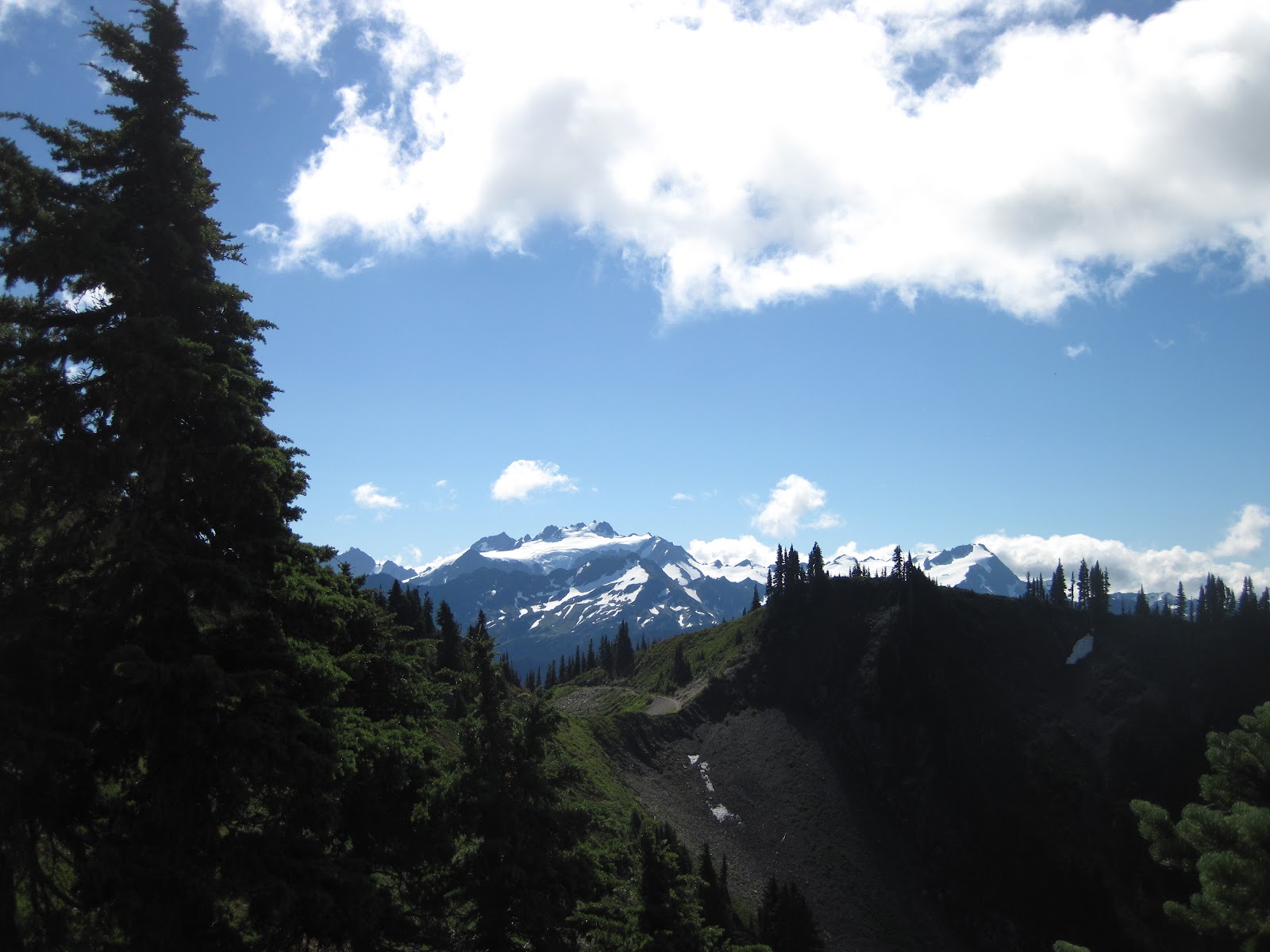
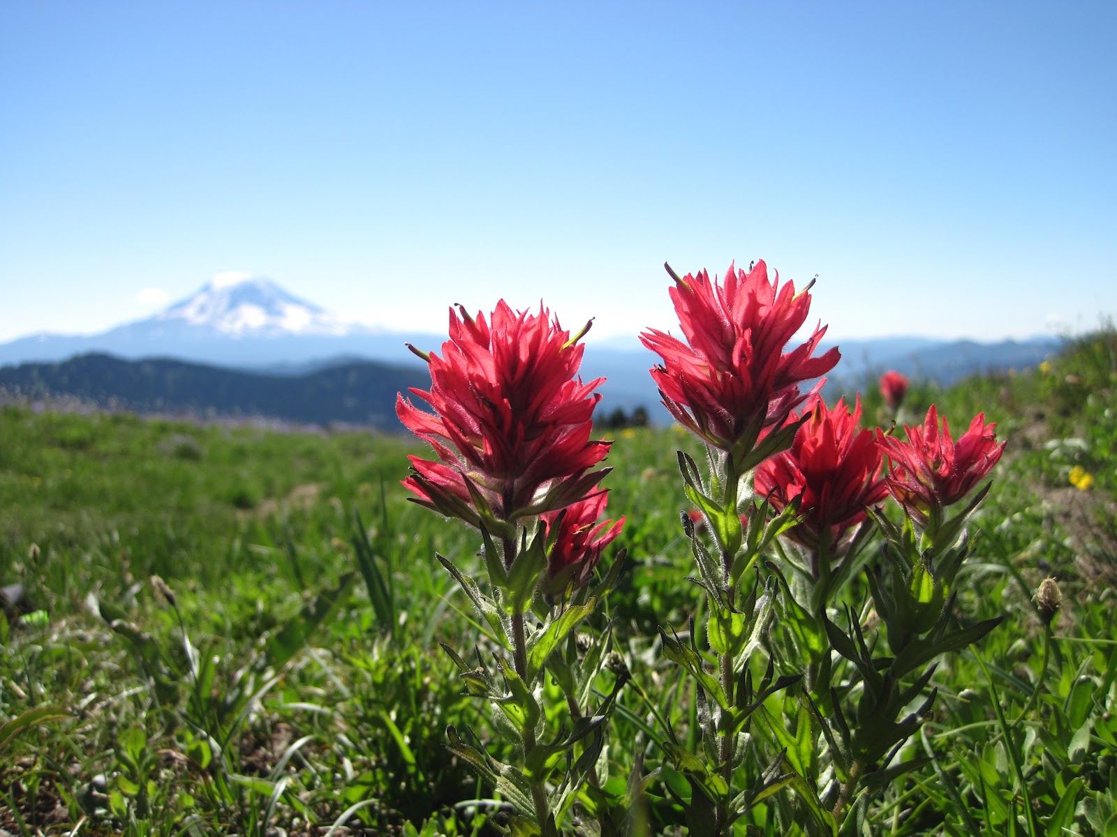
I kept moving.  Right past them, I hit a long stretch of snow.  I was thinking it would be like this the rest of the way, but I came over a crest, saw the trail, and the remainder of the hike through Moraine Park was snow free.  It was about 11:30 am, and marmots were out and about.  I love marmots so much.  They are cute, and they hop from place to place like puppies do.  I watched them and snapped a few photos.  The trail started meandering to the north, way off from where I went 4 weeks ago.  It began to climb, and I was getting ready for snow.  As I climbed up higher and higher, I encountered only little patches of snow.  I made it to the top of this ridge and I knew the rest of the trail was downhill to the lake.  I kept following the trail, and soon enough through the fog I saw Mystic Lake.

I snapped a few pictures, including my standard self portrait with the lake in the background.  I could feel my smile.  I was really happy to have made it this far in one day.  Now, I had only gone about 12.6 miles, I have gone further before.  But I knew if I made it to the lake, I would have to hike out.  I walked around the lake, where I saw a sign for a ranger station.  I thought I would go there for lunch.  The trail forked with no sign, and I chose the wrong direction.  The trail went along the lake shore and eventually stopped.  I was getting too hungry, so I set up a great spot right by the lake.  I looked at my watch, 5 hours and 20 minutes after I began my hike I sat down at the lake.

I put on some warmer layers and ate a ton.  I sat for about 30 minutes, then I thought I would go back and find the ranger station.  I got back to the fork, took the trail the other way, and then I saw him, a big, cinnamon-colored brown bear.  Now, I hike a lot in bear country and rarely see bears.  I go places where I am told I will see them, and I don't.  I was so excited that I watched him for about 15 minutes.  He was right in the way of the trail, so I couldn't continue anyway.  He did not mind me one bit.  He was more focused on whatever he was eating to pay much attention to me.  He moved far enough from the trail that I continued up and saw the ranger station.  No one was there.  I walked back down, looking closely for my new friend or any buddies he might have with him.  I came around a bend, and he had hardly moved.  I tried walking through and got within about 15 yards.  I slowly took another step, and the branch I snapped caused him to grunt and look my way.  I was definitely a little scared.  I slowly walked backwards not looking directly at him.  I then took a wide berth through the meadow off the trail.  I then quickly moved out of there.  I came around the other side of the lake where I bumped into Aaron and Karen.  We could see the bear, and they remarked that I looked like I was a little close.  I didn't realize I was being watched too.

The rest of the hike was pretty uneventful.  I began walking from Mystic at 1:30 pm.  I was back at Dick Creek Camp around 2:30 pm.  I was at the glacier at 3:15 pm, and I got down to Ipsut at 4:30 pm.  My feet were killing me, so I took of my shoes and socks and soaked my feet in the creek for 20 minutes.  I was walking the road at 5 pm.  I was at my car by 6:40 pm.

Orchid: Bear watching.

Onion: Sore feet.

Picture:
 

Google Map