Total Distance: Approximately 5 miles
Elevation Gain: Approximately 1300 ft.
Time: 10:00 am - 2:00 pm
Weather: Cool, but warm in the sun, partly sunny.
Back home in the northwest this week, and I put on my snowshoes and went out to Rainier. Earlier this week, I was talking with a former student, whom I have hiked with before, and asked if she wanted to come along. She did, and we planned a trip from Longmire up on a place called Rampart Ridge, a weird coincidence, since my last hike in Washington was just south of a different Rampart Ridge of I-90.
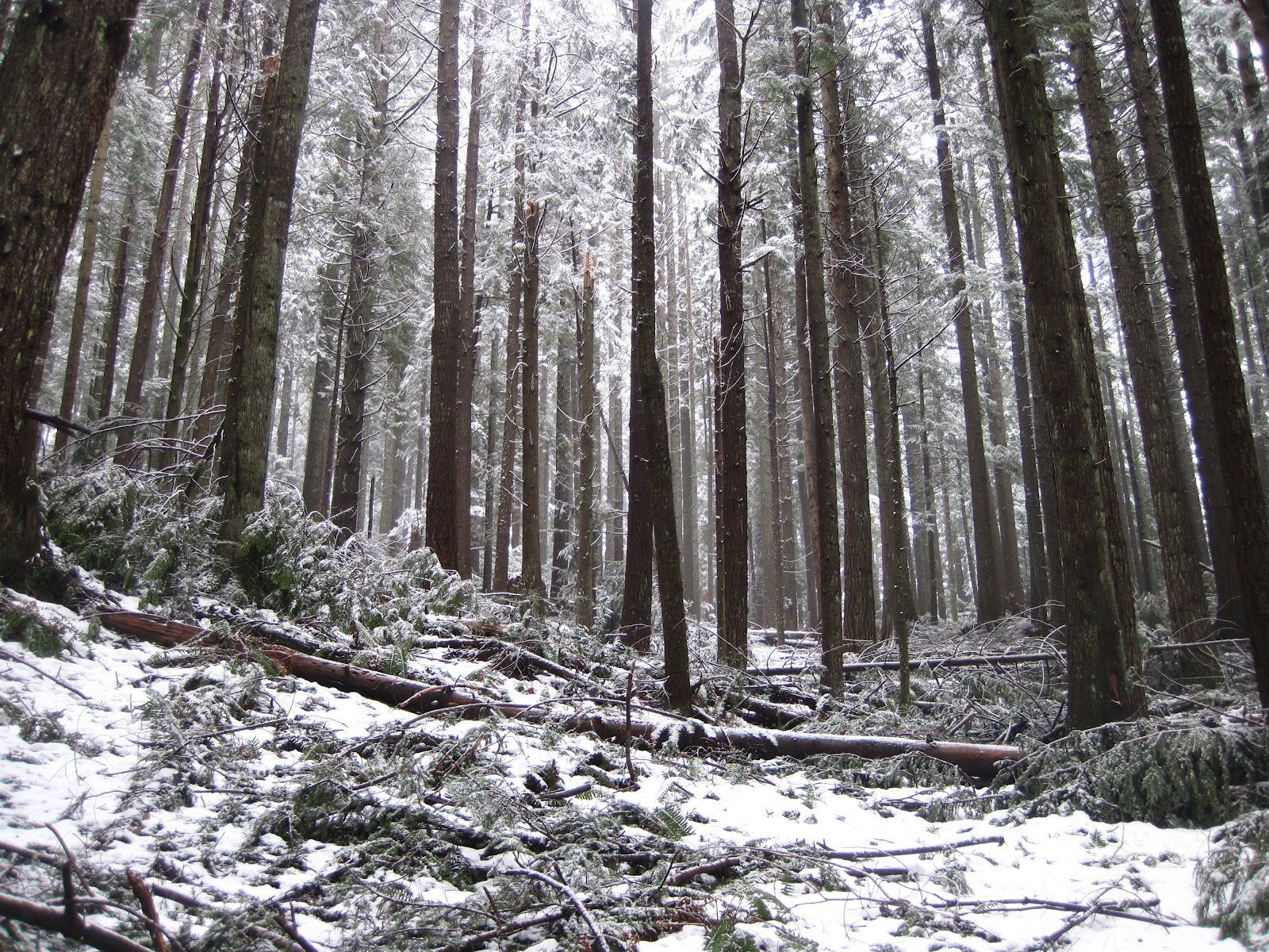
We met up around 8:15 am and were geared up and setting off on the trail by 10 am. I forgot my gaiters, but at least my rain pants did a good enough job keeping the snow out. We took the trail of the shadows to the Rampart Ridge trail. The trail switchbacks up and across the east side of Rampart Ridge. At times it is steep, but I really enjoyed being back in a forest. The sun was shinning bright through the tall trees, the trees were a brilliant green, and the sun was making the snow melt and fall from trees giving the illusion of rain on a sunny day. I missed the canyons but was glad to be home at the same time. I would close my eyes and see the red dirt and rock walls being hit with brilliant sunlight, then open them and see the thick, wet, white snow and the huge cedars and firs that stretch skyward so high it feels like you're in a cathedral.
After about an hour or so of climbing up, we finally came out on the top of the ridge. There were amazing views of the Tatoosh Mountains and the Nisqually River valley to the east. We took a little snack break and were watched by some robber jays. It was obvious they wanted us to feed them, but they seemed to be making it through winter just fine without our help. We continued on the trail, and came to some glorious views of the south side of Rainier. It was a bit unfortunate, but the clouds had settled over the top and all we got to see was the lower prominence of the peak. It was still spectacular.
We started rolling along but gradually descending. Around 12:45 pm, we saw the first two people we had seen since starting that morning. They had made their way up the Wonderland Trail and were doing the same loop in reverse. We asked them where the trail junction was, and it turned out we were only a few hundred feet from it. We turned and began heading back. Within a few minutes, we hit the junction with the Mildred Point and Van Trump Park Trail. It was another 3.5 miles just to get there then we would have to turn around, and we were both pretty tired. The last 1.8 miles were nice and easy. Sliding a bit on our butts, cutting the switchbacks in the snow. Trying not to get nailed with snow from the falling trees.
Orchid: Hiking with a friend for the first time in over a year.
Onion: Cloud obscuring the view of Rainier.
Picture:
Google Map